Mosi-oa-Tunya: Global Geography and First Impressions
Standing on the basalt lip of the gorge at golden hour, watching afternoon light cut through dense plumes of mist, you grasp why indigenous Tonga elders named this cascade Mosi-oa-Tunya—the Smoke that Thunders. The sheer physical dimension of the falling water sets it apart from every other cataract on Earth. If you wonder victoria falls is located in which continent, it sits in Southern Africa, straddling the international boundary between Zimbabwe and Zambia. In 1989, UNESCO designated the falls as a World Heritage Site, recognizing its geological significance and unmatched visual impact.
The total width spans 1,708 metres across the riverbed, dropping down into a narrow canyon beneath. With a Victoria Falls height of 108 metres, this geological phenomenon is twice as high as Niagara Falls and nearly double its width. You can explore the full contextual comparison in our Niagara vs Victoria Falls analysis, or start your trip planning at our Victoria Falls main travel guide.
Anatomy of the Zambezi River Basin
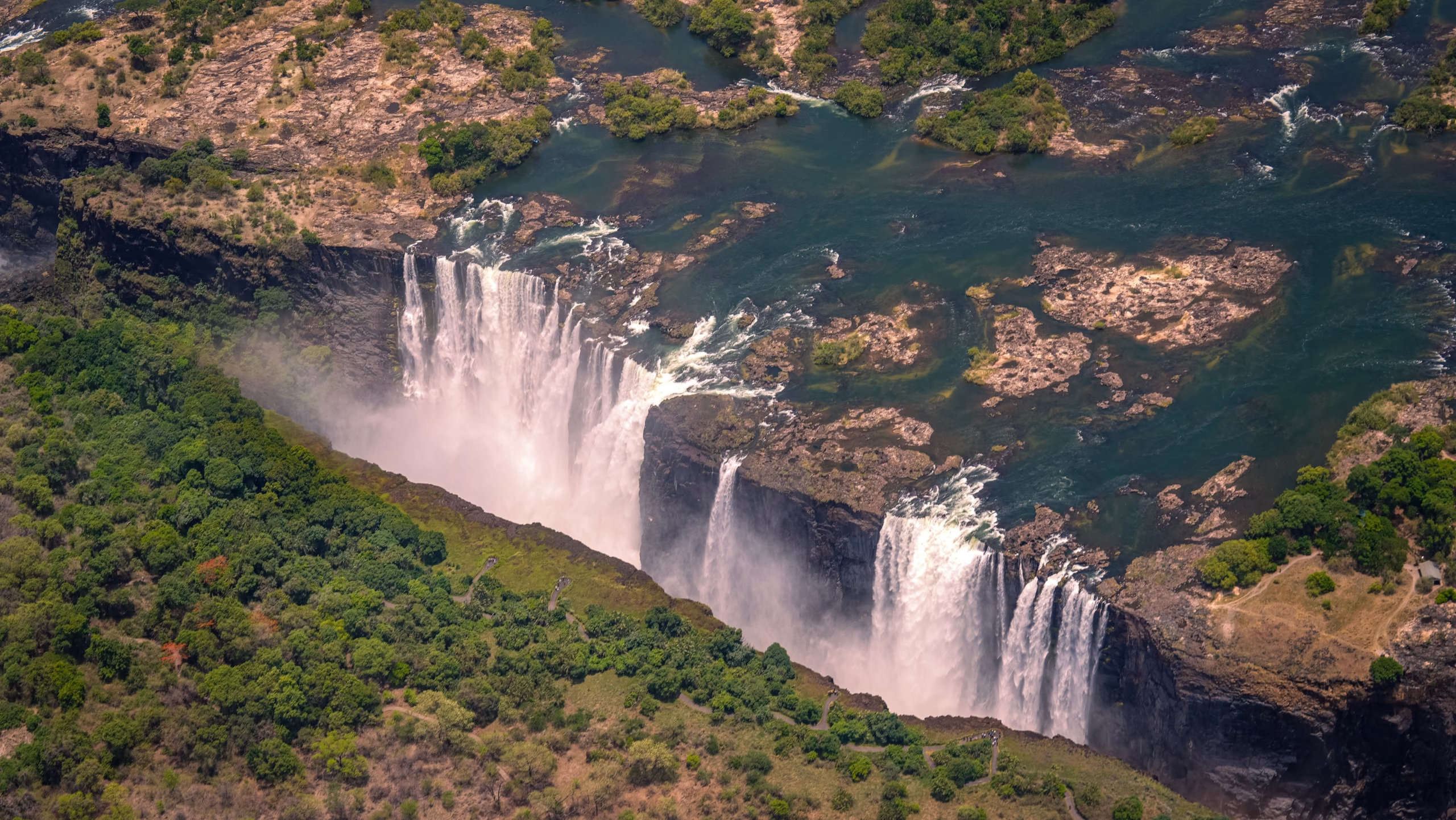
The Victoria Falls River system, known globally as the Zambezi, is the fourth-largest river basin in Africa. Originating in the marshy wetlands of north-western Zambia near the Angolan border at an elevation of 1,524 metres, the Zambezi travels nearly 2,700 kilometres before emptying into the Indian Ocean in Mozambique. Before reaching the brink, the river glides over a flat, shallow plateau of soft sandstone and volcanic rock, widening to more than 1.7 kilometres across.
Unlike river systems that drop down steep mountain valleys, the Zambezi maintains a gentle gradient across the central African plateau. Hydrological monitoring managed by the Zambezi River Authority tracks the flow rate throughout the year as water drains from an upstream catchment area covering over 1.3 million square kilometres. This vast drainage area includes the Barotse Floodplain, which acts as a massive natural sponge, regulating flow downstream.
Upper River Geography
Upstream from the precipice, the Zambezi is calm and shallow, dotted with small wooded islands like Kandahar and Palm Island. Hippos, Nile crocodiles, and elephant herds cross these waters daily, creating a quiet river landscape that gives no hints of the violent gorge waiting just around the bend.
Gorge Architecture
The moment the river hits the edge, the peaceful flow turns into a roaring torrent forced into the First Gorge—a narrow slot canyon only 60 to 110 metres wide. This sudden contraction forces the displaced air and water upward, creating powerful updrafts that carry fine mist hundreds of metres into the atmosphere.
Geological Origins: Karoo Basalt and Retreating Gorges
The foundation of Victoria Falls consists of thick layers of Karoo basalt laid down roughly 180 million years ago during massive volcanic eruptions. As teh molten lava cooled, it formed deep vertical fissures and tectonic fault lines filled with softer sedimentary material. Over thousands of centuries, the grinding action of the Zambezi River eroded these soft joint fills, carving out huge transverse trenches perpendicular to the river’s path.
Geologists have proven that the current waterfall is the eighth location in a long succession of waterfalls. Over the past 100,000 years, the river has repeatedly cut backward along successive east-west fault lines, abandoning older lips to form the zig-zagging Batoka Gorge system visible today. At the western edge of the current falls, Devil’s Cataract sits 10 metres lower than the rest of the edge. This lower elevation means the Zambezi is actively concentrating its erosive power right there, carving out what will eventually become the ninth waterfall location over the next few millennia.
The landscape here is far from static. Every litre of river water pounding against the basalt is slowly sculpting the next geological chapter of Southern Africa.
Cross-Border Geography: Zimbabwe and Zambia
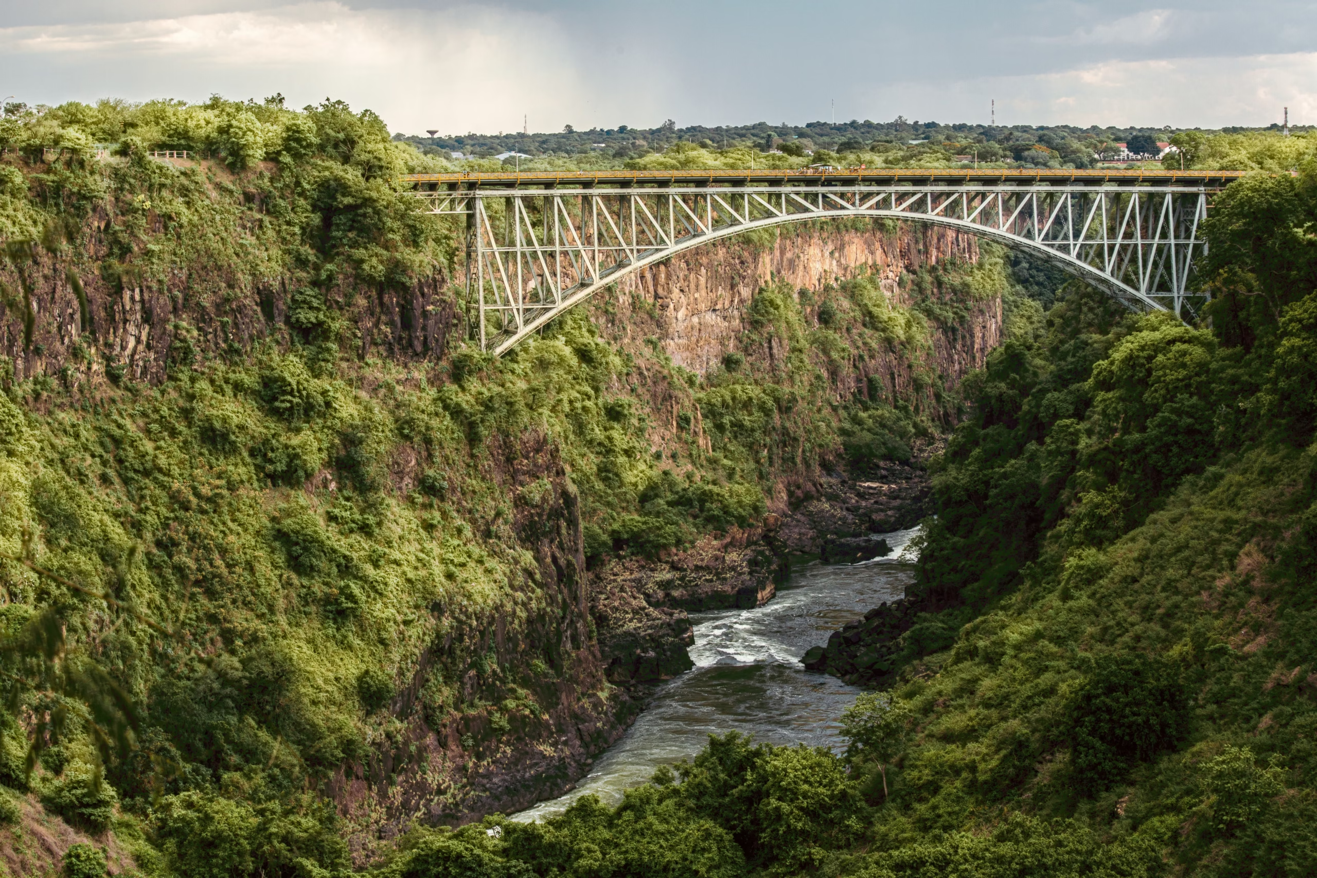
The international border runs down the deepest channel of the Zambezi River and through the center of the historic Victoria Falls Bridge in the Batoka Gorge. Managing this shared boundary requires diplomatic coordination between both nations, particularly regarding environmental conservation and cross-border tourism logistics.
Travelers can move between both sides easily using local border posts. If you are planning a trip across the border, review our guides on how to get to Victoria Falls and practical experiences and activities across both national parks. The geography varies dramatically depending on which bank you choose to stand on.
| Geographical Feature | Zimbabwe Side (Victoria Falls Park) | Zambia Side (Mosi-oa-Tunya Park) |
|---|---|---|
| Percentage of Fall Lip | 75% (Main Falls, Devil’s Cataract, Rainbow Falls) | 25% (Eastern Cataract) |
| Flow Continuity | Permanent year-round water flow | Dries to exposed basalt in low season |
| Prominent Viewpoints | 16 marked paths through rainforest mist | Knife-Edge Bridge & Boiling Pot trail |
| Special Access Features | Cataract Island views & David Livingstone statue | Devil’s Pool & Livingstone Island access |
The Zimbabwe Advantage: Viewpoints and Permanent Flow
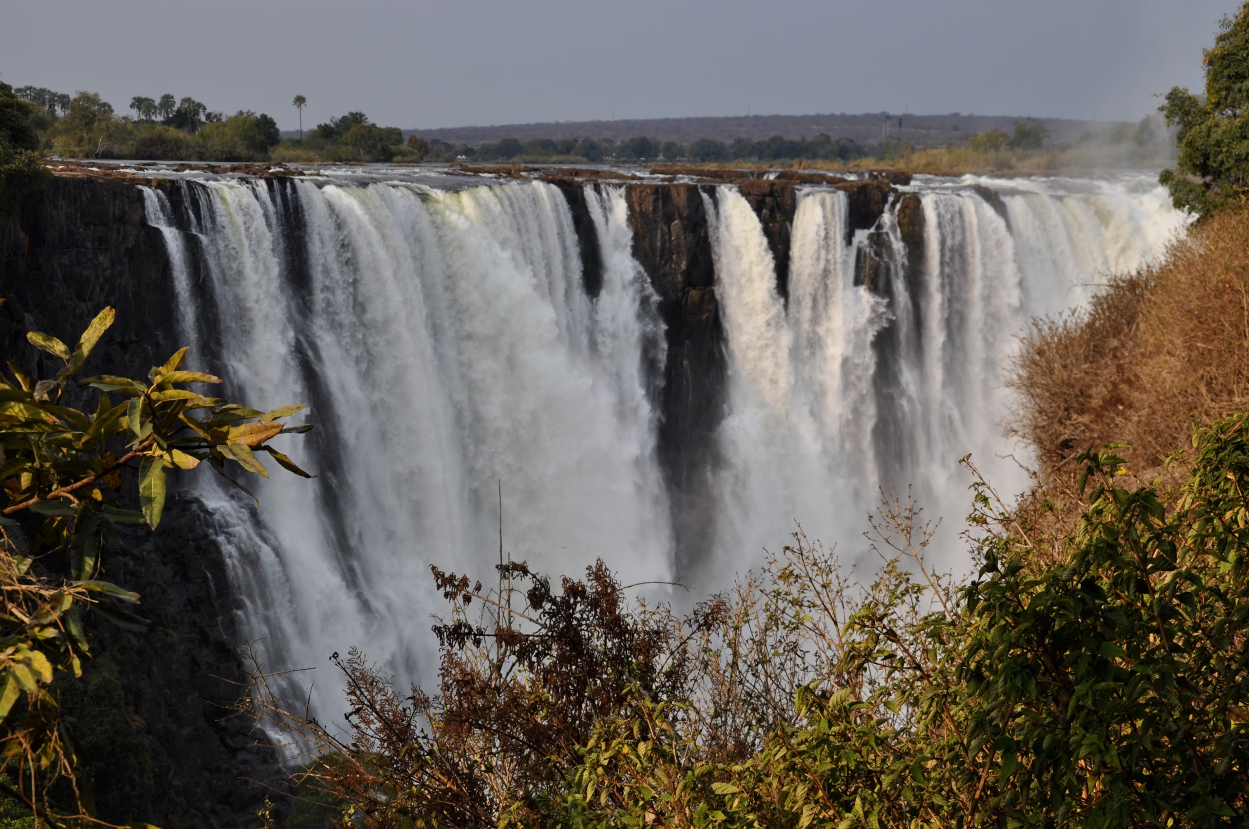
Standing on the Zimbabwean side inside the Victoria Falls National Park, you face the main curtain of water directly. Because three-quarters of the crest falls within Zimbabwean territory, this bank provides broad, sweeping views along the entire 1.7-kilometre width. More importantly, the natural topography means Devil’s Cataract and the Main Falls flow continuously, even during the driest months of the year.
Sixteen paved viewpoints wind through the rainforest edge from Viewpoint 1 at Devil’s Cataract to Viewpoint 16 overlooking the Victoria Falls Bridge. Photographers prefer the late afternoon light when warm sun rays cut through the mist at Danger Point, illuminating rainbow arches against dark rock faces. For entry passes and guided walk options, consult our tickets and tours page before visiting, and read our advice on Zimbabwe safety for international visitors.
Seasonal Dynamics: Flood Peaks and Low Water
The hydrological volume changes drastically throughout the year, driven by summer rainfall in upstream Angola and Zambia between November and March. However, because the river must pass through vast upstream floodplains, there is a two-to-three-month hydrological lag before the floodwaters actually reach the falls.
High-Water Peak (March to May)
During peak flood after local rains end, flow volume surges up to 500 million litres per minute. Spray rises over 400 metres into the air and can be seen from 50 kilometres away on the road from Bulawayo. Walking the trails during these months requires heavy waterproof gear, as the rising mist creates heavy torrential rain inside the forest zone.
Low-Water Exposure (September to December)
By late dry season, flow volume drops down to around 20 million litres per minute. While the Zimbabwean Main Falls continues flowing, the Eastern Cataract in Victoria Falls Zambia dries up completely, exposing raw Karoo basalt cliffs. This season offers incredible structural photography, showing the sheer geological drop that water usually hides. Learn more in our detailed look at Victoria Falls water levels and drought facts.
The Rainforest Microclimate and Sunbows
The continuous mist cloud generated by the waterfall has created a unique microclimate along the cliff edge on the Zimbabwean bank. This narrow strip of evergreen vegetation stands out starkly against the dry savanna woodland of Matabeleland North. Moisture-loving trees like African ebony, mahogany, red milkwood, and wild date palms flourish here alongside rich fern species.
This microclimate depends entirely on the constant humidity provided by the falls. The interaction of sunlight with airborne water droplets produces vivid optical effects. Double sunbows form across the gorge every sunny morning, whilst full moon nights produce rare lunar rainbows, or moonbows, across the mist spray cloud—a phenomenon protected under environmental guidelines by the UNESCO World Heritage Centre.
Local tip: Visit the park trails on the full moon period when authorities open the rainforest gates at night. Seeing a moonbow under silver light is an unforgettable experience.
The Batoka Gorge System and Wildlife Corridors
Below the cataract, the Zambezi River narrows sharply into the Batoka Gorge, entering a series of sharp zig-zag bends that track ancient fault lines. The water rushes through these slots with immense force, creating class-five rapids numbered 1 through 19 that attract river runners worldwide. The walls rise over 120 metres above the water, providing nesting cliffs for rare raptors including the Taita falcon, black eagle, and lanner falcon.
The surrounding national parks form a vital corridor for broad game migrations between Hwange National Park in Zimbabwe and Chobe National Park in Botswana. Elephants frequently swim across the upper Zambezi River above the falls, navigating between islands to feed on fresh greenery. To preserve this fragile ecosystem, park authorities strictly enforce safety rules for all visitors. Review our guide to park rules and conservation guidelines before visiting national park land.
Climate Change and Long-Term Hydrological Variability
Climate monitoring by the Zimbabwe Parks and Wildlife Management Authority and international research teams shows that while extreme drought years occur during El Niño cycles, long-term average flow patterns remain stable over multi-decade cycles. Sensational claims that Victoria Falls is drying permanently fail to account for the dramatic seasonal swing inherent to sub-Saharan hydrology.
Understanding these hydrological cycles helps travelers plan their visits based on what they want to experience. High water delivers immense raw power and deafening thunder, whilst low water reveals detailed basalt rock formations and allows safe access to swimming spots like Devil’s Pool on the river lip that visitors come from all over the world to look at.
Frequently Asked Questions
How much water flows over Victoria Falls at peak capacity?
At peak capacity during flood season between March and May, the river discharges up to 500,000,000 litres of water per minute over the lip. The average year-round discharge rate sits at roughly 1,088 cubic metres per second, though this varies greatly between rainy and dry periods.
Why does peak water flow happen months after the local rainy season?
Local rains fall between November and March, but the bulk of the river’s water comes from upper catchment areas thousands of kilometres upstream in Angola and Zambia. This water must slowly travel through the vast Barotse Floodplain wetland system, creating a two-to-three-month hydrological delay before reaching the waterfall edge in Zimbabwe.
Can parts of Victoria Falls completely dry up?
During the October to December dry season, the Zambian side (Eastern Cataract) frequently dries up completely, leaving bare basalt cliffs exposed. However, the Zimbabwean side—specifically Main Falls and Devil’s Cataract—maintains steady water flow year-round due to the lower elevation of the riverbed on the western bank.
How high does the spray cloud rise into the sky?
During high-water season, the spray column rises over 400 metres (1,300 feet) into the air as displaced air rushes out of the narrow gorge. This towering column of mist is visible from up to 50 kilometres away on clear days, earning the site its indigenous name Mosi-oa-Tunya.
Which country offers a better view of the geographical layout?
Zimbabwe contains 75% of the waterfall lip and provides broad, face-on panoramic views along 16 paved trail viewpoints inside Victoria Falls National Park. Zambia offers close-up perspective from the Knife-Edge Bridge and access to the riverbed at the Boiling Pot, making a cross-border visit ideal for seeing both sides of the geographical layout.