10 Fascinating Facts About Victoria Falls You Probably Didn’t Know
The personality of the river changes drastically depending on when you choose to visit. The Zambezi drainage basin covers over 1.3 million square kilometres, collecting summer rains in the high marshlands of northwestern Zambia and eastern Angola. This deluge flows slowly downstream across massive floodplain swamps, reaching Victoria Falls several months after the rain actually falls.
| Season | Timing | Flow Characteristics | Visual Experience |
|---|---|---|---|
| Peak Flood | March – May | Up to 500 million litres per minute | Thunderous roar, massive spray, reduced canyon visibility |
| High Water | June – August | Moderate to strong continuous flow | Clear views, powerful drops, vibrant rainbows |
| Low Water | September – November | Dramatically reduced discharge | Exposed basalt rock, clear gorge views, safe Devil’s Pool access |
| Rising Water | December – February | Gradual rise following local rains | Fresh green growth, increasing water volume |
During peak flow in April, the water volume surges so violently that the rising spray masks the lower half of the falls in an impenetrable wall of white mist. By November, flow levels drop significantly, exposing the dark, polished rock face on the Zambian side entirely. To plan your trip around these hydrologic cycles, consult our complete breakdown on seasonal water level shifts and drought context.
9. The Devil’s Boiling Pot and Treacherous Hidden Currents
At the base of the First Gorge, directly beneath the railway bridge, the entire volume of the broad river is squeezed into a narrow neck barely 110 metres wide. This geographic choke point forces the current to make an abrupt ninety-degree turn to the left, plunging into a deep, swirling pool known as the Boiling Pot. During high water, the immense hydraulic pressure creates massive, unpredictable upwellings that suck water down before spitting it out in roaring white-water boils.
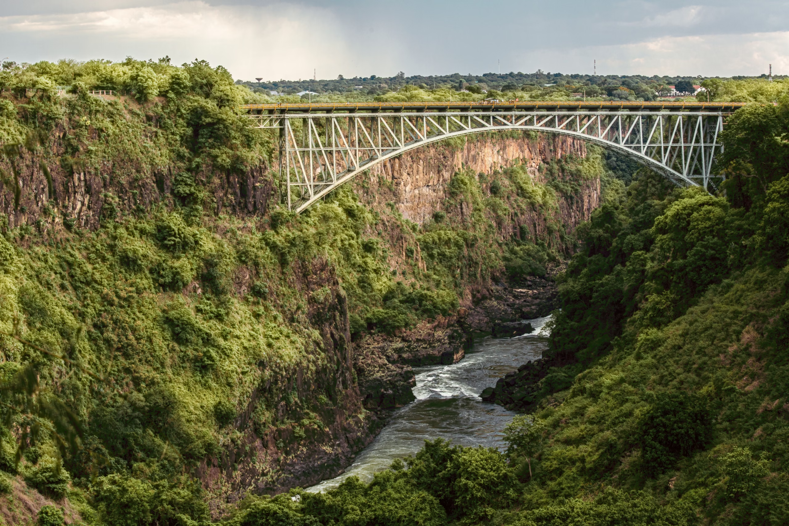
Navigating this stretch of water requires extreme care. Below the Boiling Pot lies the start of the Batoka Gorge rapids, widely regarded by international river runners as containing some of the most intense commercial white-water rafting on Earth. The sheer depth of the gorge, coupled with subterranean rock ledges, creates powerful hydraulics that demand respect from even the most seasoned river guides. For visitor safety rules near edge paths, consult the official guidelines published by ZimParks before exploring the edge.
10. River Wildlife Adaptations, from Palm Islands to Nocturnal Fishing Owls
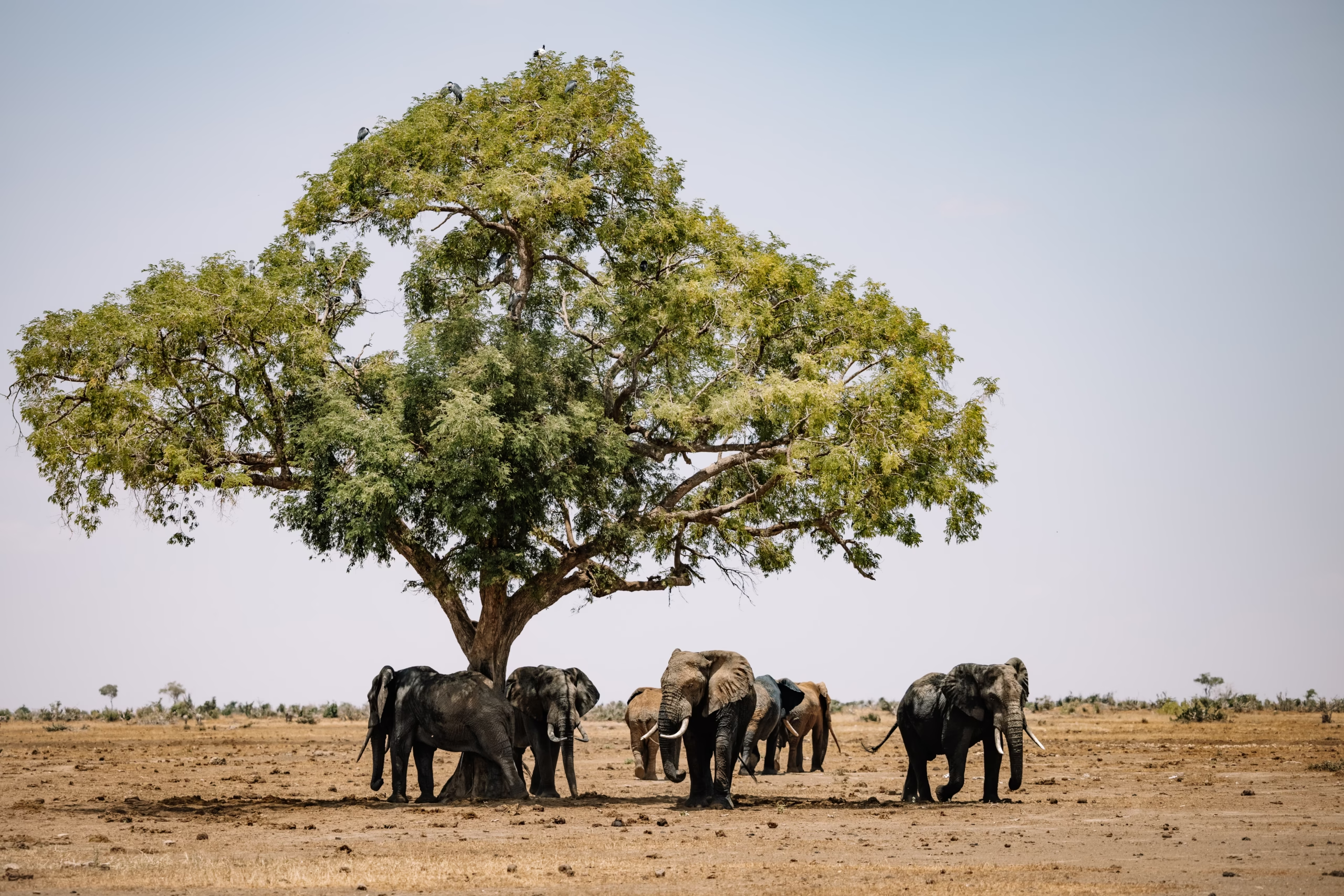
The ecosystem surrounding the waterfall supports a astonishing array of wildlife adapted to riverine living. The calm upper Zambezi, just hundreds of metres before the edge, features lushly vegetated islands like Siloka Island and Kandahar Island. These isolated sanctuaries serve as safe breeding grounds for hippopotamus pods, large Nile crocodiles, and visiting elephant herds that swim across the river channels during low-water months.
Along the quiet river margins overhead, the elusive Pel’s fishing owl roosts in the dense shady foliage of riverine mahogany trees. These large, ginger-colored nocturnal raptors lack the fringed feathers typical of other owls, allowing them to drop quietly onto fish near the water surface without getting waterlogged. Spotting one hunting at dusk along the palm channels is a highlights for any visiting birder.
Plan Your Excursion to the Smoke That Thunders
Understanding these ecological and geological layers turns a simple holiday into a rich exploration of Africa’s most iconic river basin. Every season brings something distinct to the precipice, from the deafening thunder of high flood to the exposed geological fractures of late dry season. Every victoria falls tourist should take time to walk the rainforest paths slowly, taking in both the immense scale and the quiet natural details that surround the fall.
Before heading out to the national park lookout points, ensure you review essential entry rules, park opening hours, and safety recommendations in our official visitor safety guidelines. For details on border procedures, taxi arrangements, and local flights, check our complete transport and border crossing guide to make your journey through Zimbabwe seamless from start to finish.
Teh sheer power of Mosi-oa-Tunya leaves an indelible mark on everyone who visits, offering a timeless reminder of nature’s raw force that you simply have to witness for yourself to appreciate where all the magic comes from.
Most first-time visitors arrive in Victoria Falls with a mental picture formed by travel brochures and quick social media clips. They anticipate a sheer drop of water, a rainbow across the canyon, and a dramatic vantage point for an afternoon photograph. Living on the doorstep of this geological giant in Zimbabwe, I see how quickly those basic expectations dissolve once people stand beside the precipice. Behind the thunderous curtain lies an astonishing array of deep history, geological migration, and natural anomalies that rarely make the headlines.
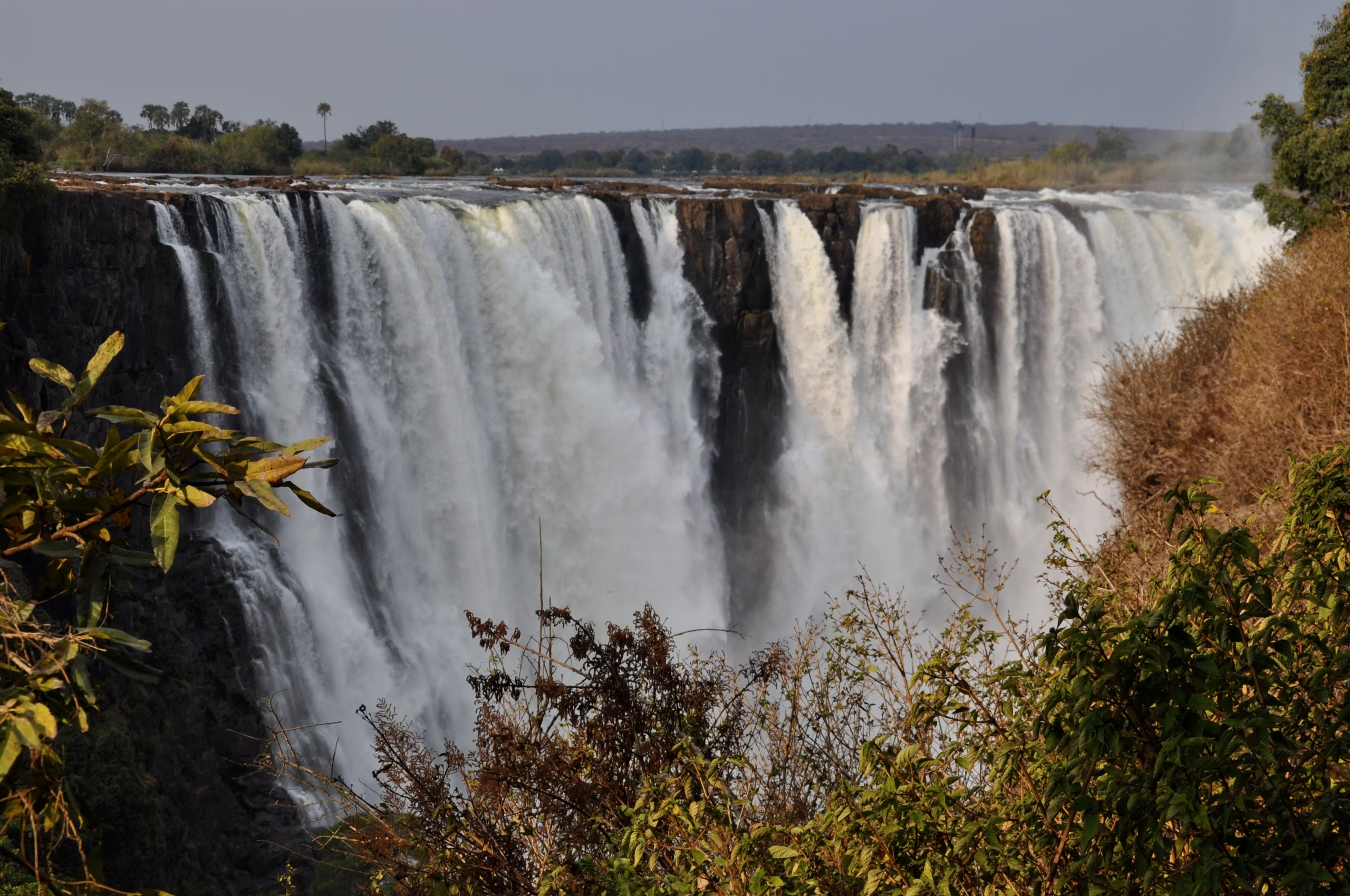
Uncovering these 10 facts about Victoria Falls offers a far richer perspective on why this landscape holds such a sacred place in regional heritage. From ancient human footsteps in the basalt sediment to a nocturnal rainbow visible only by moonlight, the stories embedded in these rocks reveal a dynamic, evolving environment that changes with every season.
1. The Indigenous Names Predating Livingstone
Centuries before foreign explorers mapped southern Africa, local indigenous communities possessed an intimate understanding of the canyon and its hydraulic power. The Toka Leya people who lived along the river margins called the cascade Shongwe, a word referring to a boiling pot or deep boiling cauldron, which accurately describes the ferocious white-water kettle created at the base of the gorge. Around 1834, the Karanga-speaking people migrated into the district and bestowed the name Mosi-oa-Tunya, translating directly to “The Smoke That Thunders.”
This descriptive phrasing refers to both the visual plume of rising mist, which towers over four hundred metres above the gorge rim during flood season, and the low-frequency acoustic vibrations that travel through the earth for several miles. Long before written maps existed, surrounding communities treated the precipice as a sacred sanctuary, holding quiet rituals along the palm-fringed banks upstream while honoring the spirit of the river, Nyami Nyami. Today, both UNESCO World Heritage Centre records and regional Zimbabwean laws recognise Mosi-oa-Tunya alongside its colonial title, preserving the cultural lineage of the land.
2. The Waterfall is Actually Walking Upstream
The geography visible today is merely a temporary snapshot in a long, relentless process of geological retreat. Millions of years ago, the Zambezi River spilled across a flat basalt plateau formed by ancient lava flows. Over thousands of centuries, the massive weight of the river attacked natural fault lines and soft fractures running east-to-west across the hard volcanic rock, grinding out deep subterranean trenches in a process called headward erosion.
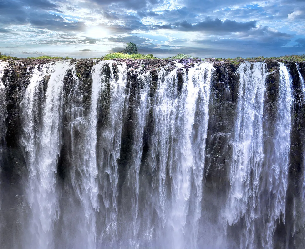
As each transverse fissure eroded completely, the lip of the fall collapsed backward into the newly formed canyon. The river has abandoned seven previous waterfall locations over time, creating the sharp, zigzagging chasms of Batoka Gorge downstream. Geologists note that the current lip, located at the Devil’s Cataract on the Zimbabwean side, is already fracturing along a weak diagonal fracture line. Over the next several thousand years, the entire edge will shift northward into an eighth distinct gorge, carving out a fresh lip further upstream.
3. The Rare Phenomenon of the Nighttime Moonbow
Daytime visitors routinely spot brilliant double rainbows arching over the main abyss when the golden hour light strikes the mist at a low forty-two-degree angle. Far fewer travellers realize that the exact same optical physics occurs under the cover of darkness. During high water months between February and August, when the spray plume rises thick and dense into the cool evening air, a full moon illuminates the mist to generate a lunar rainbow, often called a moonbow.
Local Tip: The lunar rainbow is best photographed with a long tripod exposure. To the human eye, the arc appears as a surreal, ghostly silver band, but a ten-second camera exposure uncovers rich blues, greens, and reds hidden within the midnight spray.
Victoria Falls is one of only a handful of places on Earth where this atmospheric phenomenon occurs on a predictable monthly schedule. National park authorities open the rainforest gates for three consecutive nights during the full moon cycle, allowing small groups to walk the damp stone trails under starry skies. If you intend to photograph this nocturnal magic, review our dedicated guide to regional experiences and guided excursions to check monthly full moon opening calendars.
4. David Livingstone’s Diary Entry and the Myth of Discovery
Popular historical accounts often attribute the “discovery” of the waterfall to Scottish missionary and explorer David Livingstone in November 1855. Local African paddlers from the Makololo tribe actually navigated Livingstone down the upper Zambezi in dugout canoes, guiding him safely to the small landmass now named Livingstone Island perched directly on the lip of the drop. He was simply the first documented European to lay eyes on the chasm, rather than the original discoverer.
Livingstone famously recorded in his journals that scenes so lovely must have been gazed upon by angels in their flight, a quote that remains etched into travel literature across the world. He renamed the geological feature after Queen Victoria, ignoring the established indigenous names. Decades later, during the late nineteenth century, early colonial settlements established administrative bases here under the British South Africa Company. Historical archives covering the broader era of victoria falls rhodesia show how rapid railway construction transformed a remote river crossing into a major transport hub on the Cape-to-Cairo railway route.
5. The Microclimate Rainforest Sustained Entirely by River Spray
Step through the national park entry gate and the surrounding dry teak woodlands abruptly yield to a dense, drenched evergreen rainforest. This verdant strip of forest extends along the edge of the Zimbabwean cliff directly opposite the falling water sheet. The forest does not depend on regional rainfall patterns; instead, it is sustained entirely by the perpetual rising spray cloud that rains down on the vegetation 365 days a year.
Flora Adaptations
Rare ebony trees, wild date palms, and sprawling mahogany trees create an interlocking overhead canopy. Below, broad-leafed ferns and delicate epiphytic orchids cling to the damp volcanic stone, absorbing moisture directly from the cloud droplets.
Fauna in the Canopy
Bushbuck tread quietly through the underbrush, completely comfortable in the wet conditions. Vervet monkeys and colorful bushbabies move through the canopy trees, whilst red-chested cuckoos call out through the dense foliage.
Because the spray functions as a continuous artificial rain shower, tropical plant species flourish here that cannot survive anywhere else in the semi-arid drought zone of western Zimbabwe. Visitors walking the path should prepare for complete saturation during high-water season, making a sturdy waterproof phone pouch or dry bag essential equipment.
6. It Is Not the Highest or Widest Separately, But the Largest Single Sheet
Statistical claims surrounding famous waterfalls often cause confusion for international tourists. South America’s Angel Falls holds the absolute title for vertical height, dropping nearly a full kilometre, while Iguazu Falls along the border of Brazil and Argentina spans a wider total distance across fractured island chains. Niagara Falls moves a massive volume of water, yet it lacks the dramatic single drop height seen in Africa.
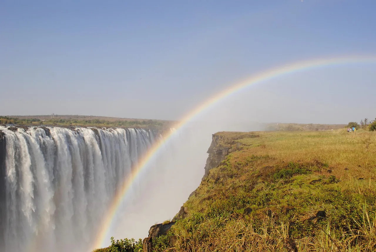
Victoria Falls claims its undisputed world record through a combination of width and vertical drop height. Stretching 1,708 metres across and plunging 108 metres straight into the basalt chasm, it forms the largest single continuous sheet of falling water anywhere on the planet. For a granular look at how these measurements compare line by line with North America’s premier cascade, read our detailed analysis on Victoria Falls versus Niagara Falls.
7. Ancient Hominin Footprints and 1.5 Million Years of Human History
The human history of this valley stretches back far beyond written records or colonial explorations. Archaeological excavations conducted along the river terraces around victoria falls city zimbabwe have unearthed heavy stone handaxes, primitive scrapers, and ancient butchering tools buried within old river gravels. These stone artifacts confirm that early human ancestors, including Homo erectus, occupied the banks of the upper Zambezi more than 1.5 million years ago.
As the river eroded sequential gorges over millennia, early human populations shifted their campsites to remain near fresh water and abundant game paths. Later Middle and Late Stone Age hunter-gatherer groups left behind refined quartzite spearheads and arrow tips throughout the Batoka Basin. Standing at a modern viewpoint, you occupy a location that has served as a critical oasis for hominin survival across dozens of ice ages and climate shifts.
8. The Incredible Volume and Rhythmic Seasonal Swings
The personality of the river changes drastically depending on when you choose to visit. The Zambezi drainage basin covers over 1.3 million square kilometres, collecting summer rains in the high marshlands of northwestern Zambia and eastern Angola. This deluge flows slowly downstream across massive floodplain swamps, reaching Victoria Falls several months after the rain actually falls.
| Season | Timing | Flow Characteristics | Visual Experience |
|---|---|---|---|
| Peak Flood | March – May | Up to 500 million litres per minute | Thunderous roar, massive spray, reduced canyon visibility |
| High Water | June – August | Moderate to strong continuous flow | Clear views, powerful drops, vibrant rainbows |
| Low Water | September – November | Dramatically reduced discharge | Exposed basalt rock, clear gorge views, safe Devil’s Pool access |
| Rising Water | December – February | Gradual rise following local rains | Fresh green growth, increasing water volume |
During peak flow in April, the water volume surges so violently that the rising spray masks the lower half of the falls in an impenetrable wall of white mist. By November, flow levels drop significantly, exposing the dark, polished rock face on the Zambian side entirely. To plan your trip around these hydrologic cycles, consult our complete breakdown on seasonal water level shifts and drought context.
9. The Devil’s Boiling Pot and Treacherous Hidden Currents
At the base of the First Gorge, directly beneath the railway bridge, the entire volume of the broad river is squeezed into a narrow neck barely 110 metres wide. This geographic choke point forces the current to make an abrupt ninety-degree turn to the left, plunging into a deep, swirling pool known as the Boiling Pot. During high water, the immense hydraulic pressure creates massive, unpredictable upwellings that suck water down before spitting it out in roaring white-water boils.
Navigating this stretch of water requires extreme care. Below the Boiling Pot lies the start of the Batoka Gorge rapids, widely regarded by international river runners as containing some of the most intense commercial white-water rafting on Earth. The sheer depth of the gorge, coupled with subterranean rock ledges, creates powerful hydraulics that demand respect from even the most seasoned river guides. For visitor safety rules near edge paths, consult the official guidelines published by ZimParks before exploring the edge.
10. River Wildlife Adaptations, from Palm Islands to Nocturnal Fishing Owls
The ecosystem surrounding the waterfall supports a astonishing array of wildlife adapted to riverine living. The calm upper Zambezi, just hundreds of metres before the edge, features lushly vegetated islands like Siloka Island and Kandahar Island. These isolated sanctuaries serve as safe breeding grounds for hippopotamus pods, large Nile crocodiles, and visiting elephant herds that swim across the river channels during low-water months.
Along the quiet river margins overhead, the elusive Pel’s fishing owl roosts in the dense shady foliage of riverine mahogany trees. These large, ginger-colored nocturnal raptors lack the fringed feathers typical of other owls, allowing them to drop quietly onto fish near the water surface without getting waterlogged. Spotting one hunting at dusk along the palm channels is a highlights for any visiting birder.
Plan Your Excursion to the Smoke That Thunders
Understanding these ecological and geological layers turns a simple holiday into a rich exploration of Africa’s most iconic river basin. Every season brings something distinct to the precipice, from the deafening thunder of high flood to the exposed geological fractures of late dry season. Every victoria falls tourist should take time to walk the rainforest paths slowly, taking in both the immense scale and the quiet natural details that surround the fall.
Before heading out to the national park lookout points, ensure you review essential entry rules, park opening hours, and safety recommendations in our official visitor safety guidelines. For details on border procedures, taxi arrangements, and local flights, check our complete transport and border crossing guide to make your journey through Zimbabwe seamless from start to finish.
Teh sheer power of Mosi-oa-Tunya leaves an indelible mark on everyone who visits, offering a timeless reminder of nature’s raw force that you simply have to witness for yourself to appreciate where all the magic comes from.